Water Security
Research will investigate surface-water and groundwater forecasting, water-stress assessment, and scenario-based planning using multimodal Earth system data and scientific models.
Planned researchClimate Co-Pilot
Climate Co-Pilot currently advances two core research directions in multimodal Earth system learning and intelligent agent systems, alongside longer-term applications in water and food security.
Research Direction 01
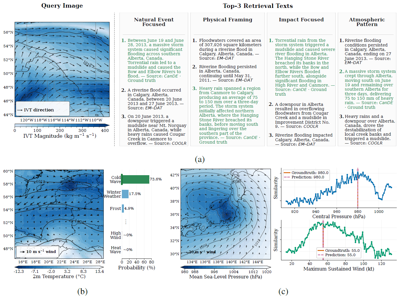
This research investigates how heterogeneous Earth system information can be represented jointly with natural language, enabling reusable representations for retrieval, interpretation, quantitative inference, and future multimodal interaction.
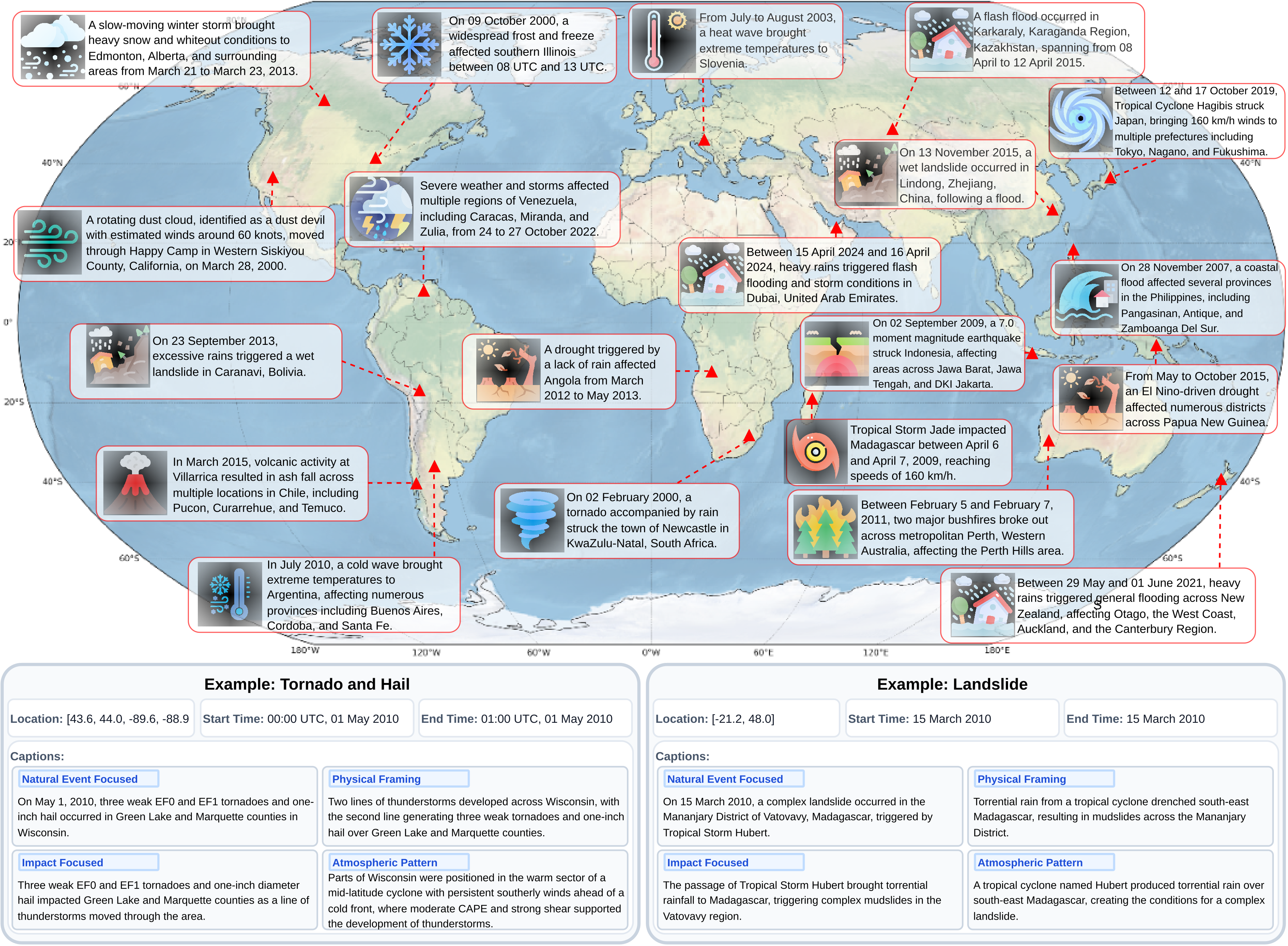
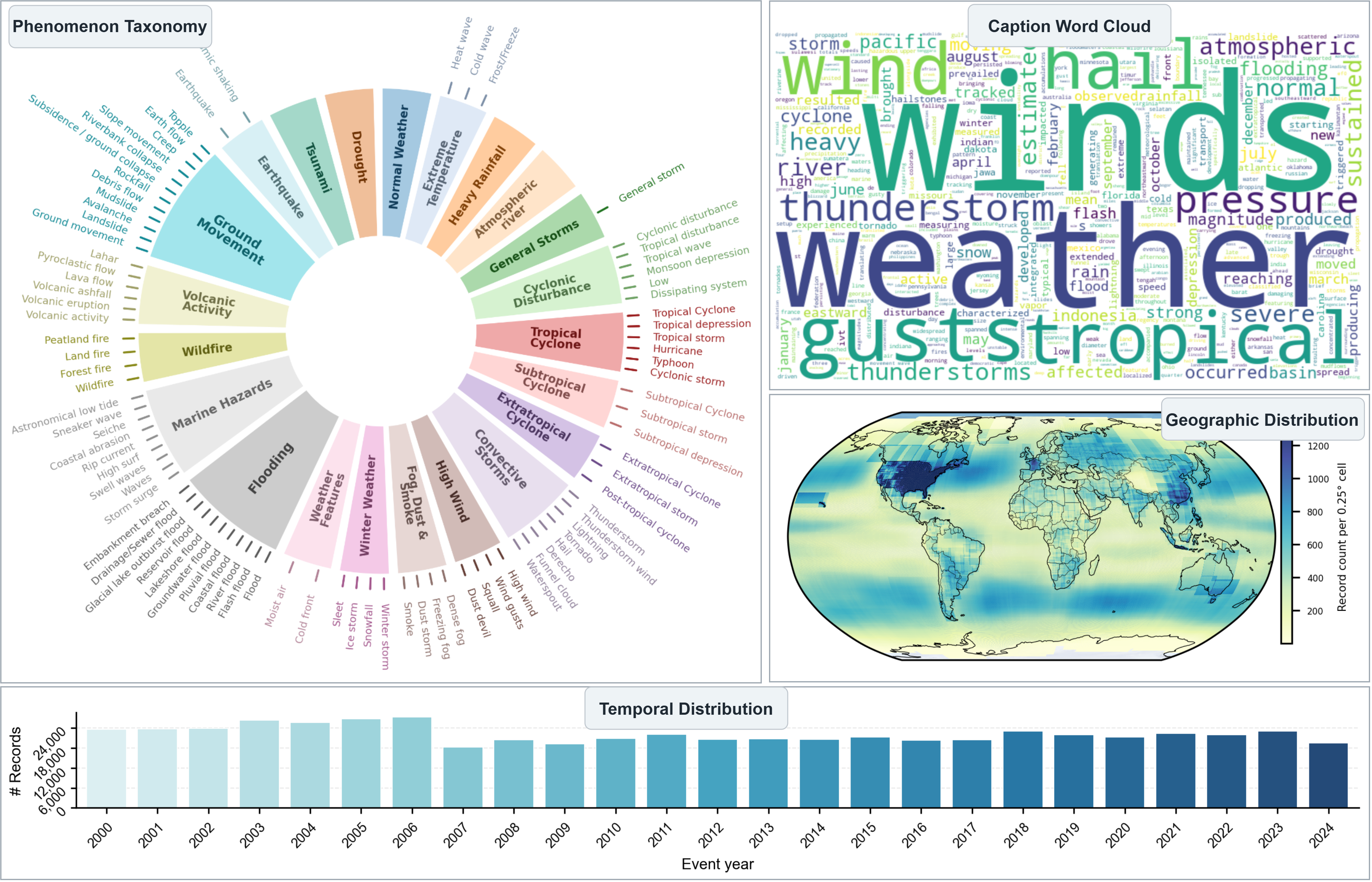
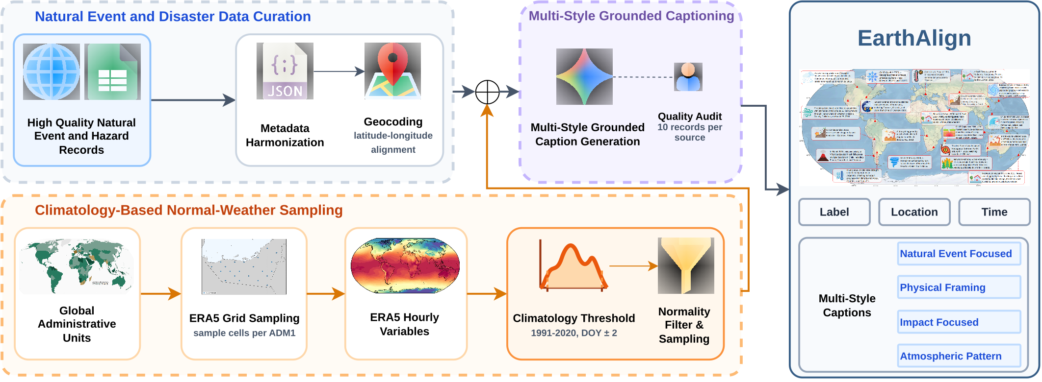
EarthAlign is a large-scale Earth system-language dataset containing 553,738 samples spanning 2000–2024. It combines records from 10 expert-curated natural event and disaster sources with climatology-derived normal weather samples. Each sample is paired with 63-variable ERA5 meteorological data and four metadata-grounded natural-language caption styles.
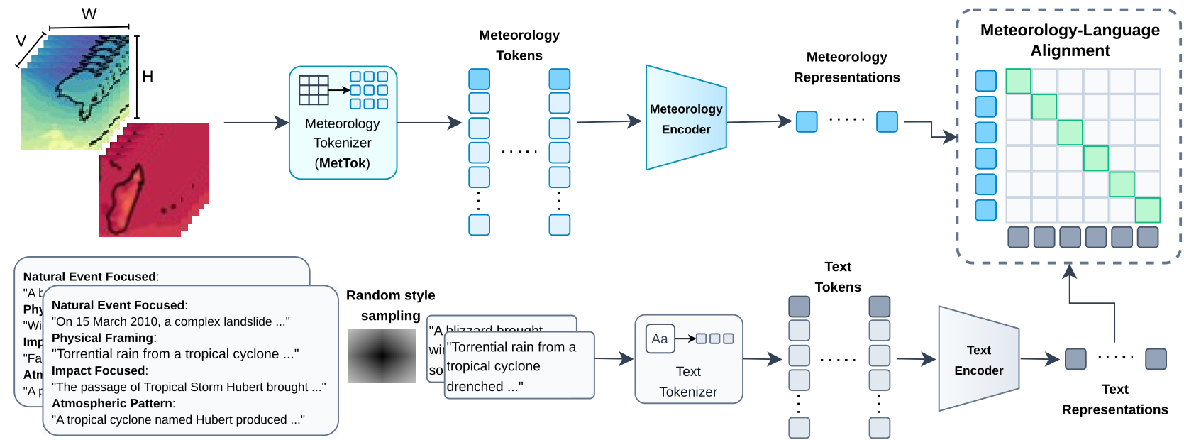
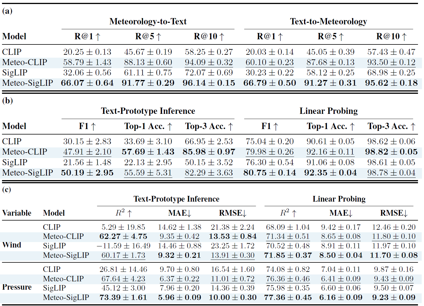
MeteoLIP is a multimodal representation learning framework that aligns ERA5 meteorological snapshots with natural language. It is evaluated on cross-modal retrieval, weather-condition classification, and physical variable estimation, demonstrating substantial improvements over corresponding CLIP and SigLIP baselines.
Resources: Dataset & Weights
Research Direction 02
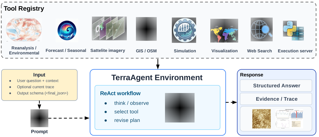
This research investigates how language-model agents can coordinate scientific data, tools, models, and simulations to solve complex Earth system analysis tasks.
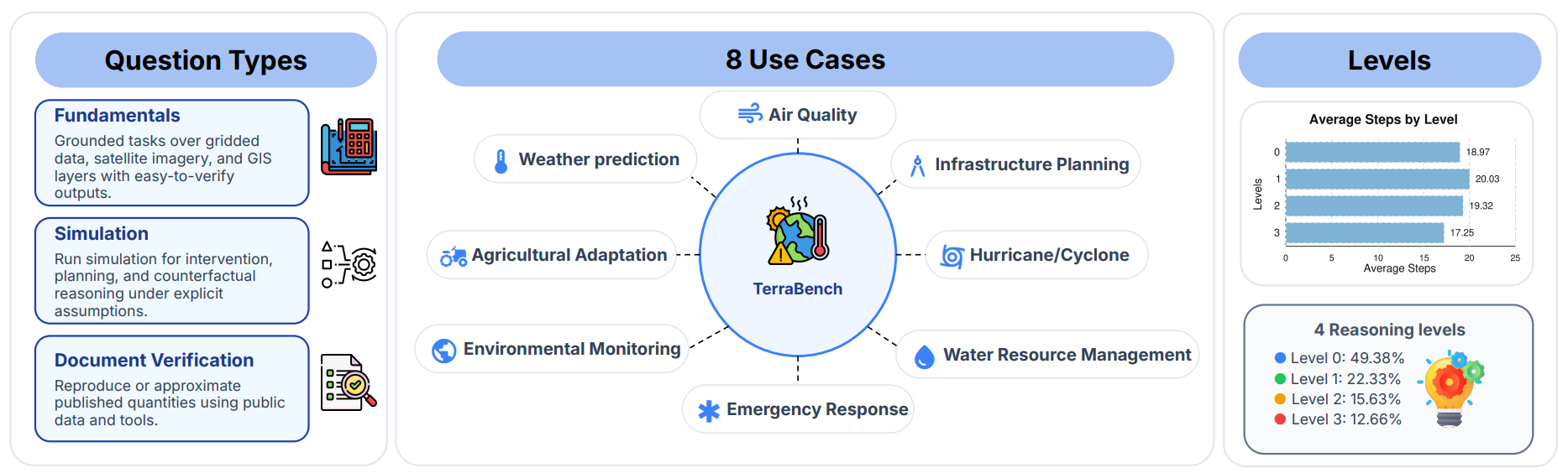
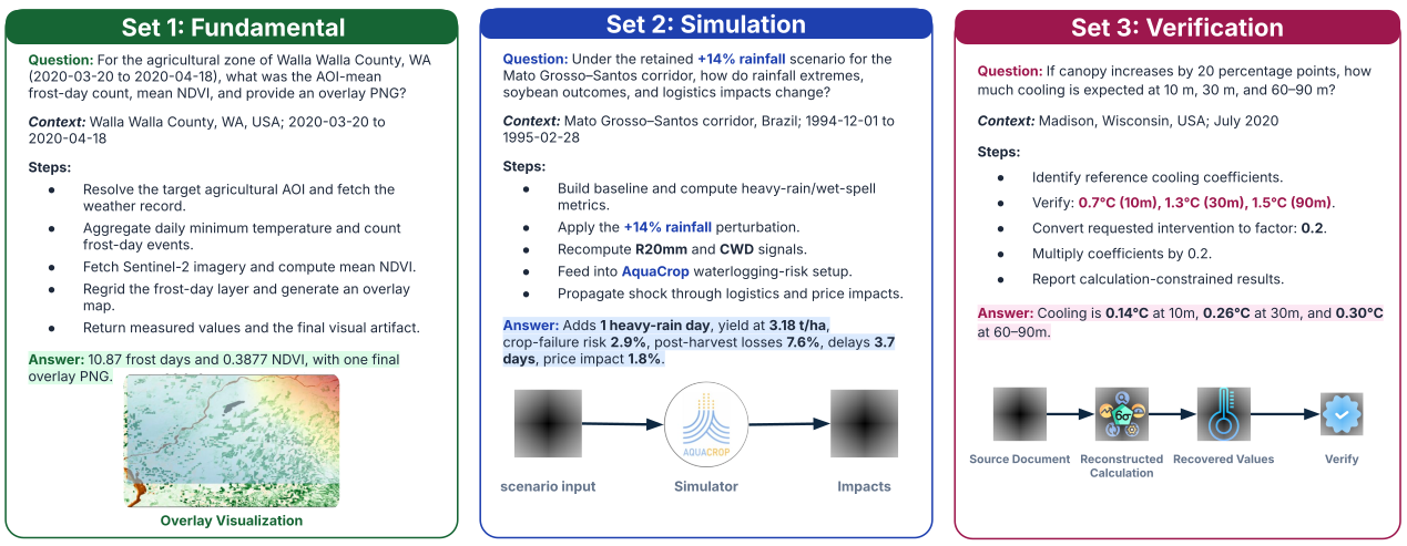
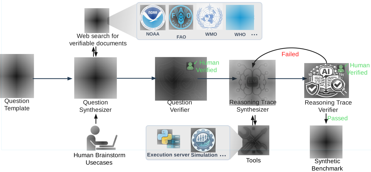
TerraAgent provides an executable framework for tool-augmented Earth system reasoning, while TerraBench evaluates agents across heterogeneous scientific workflows involving Earth observation imagery, gridded environmental data, GIS reasoning, simulation, and document-grounded verification.
TerraBench comprises 403 executable tasks across 3 tracks and 8 application domains, supported by 77 scientific tools and approximately 24,500 verified execution steps. Evaluation reveals a substantial gap between successful scientific tool use and final numerical correctness, highlighting the importance of outcome-based evaluation and numerical grounding.
Research Direction 03
Later project phases will translate the underlying multimodal and agentic capabilities into application-specific systems for climate resilience in MENA.
Research will investigate surface-water and groundwater forecasting, water-stress assessment, and scenario-based planning using multimodal Earth system data and scientific models.
Planned researchResearch will investigate crop heat and water stress, temporal vegetation dynamics, and adaptation strategies for climate-sensitive agriculture.
Planned research